


Introduction: Mount Fuji – Japan’s Geological Masterpiece
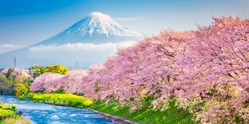
Mount Fuji, standing tall at 3,776 meters (12,389 feet), is not only a national symbol of Japan but also a geological marvel that has shaped the landscape for thousands of years. As the tallest volcano in Japan, Fuji-san has been a focal point for geologists, adventurers, and spiritual seekers alike. Its perfectly symmetrical silhouette is recognized worldwide, but behind its striking beauty lies a complex geological history that has fascinated earth scientists for generations.
The lava rock zones surrounding Mount Fuji and its varied natural landscapes provide an extraordinary opportunity for those interested in volcanic geology. These regions offer a detailed insight into the processes of volcanic activity, lava flow patterns, erosion, and the interplay between tectonic forces and natural elements. The unique geological features of Fuji’s lava rock zones create an awe-inspiring and diverse environment that draws geology enthusiasts, environmental scientists, and nature lovers from all over the globe.
This article will explore the lava rock regions of Mount Fuji, the surrounding volcanic landscapes, and the incredible geological formations that make this area a dream destination for those seeking to study the forces that shape the Earth. Additionally, we will examine the natural wonders found around Mount Fuji, ranging from ancient forests to pristine lakes, all shaped by the powerful forces of volcanism.
1. Mount Fuji’s Volcanic Origins
1.1 The Formation of Mount Fuji
Mount Fuji is a stratovolcano—a type of volcano formed by alternating layers of lava flows and pyroclastic material, such as ash and volcanic rock. Over the course of thousands of years, the successive eruptions of Mount Fuji have built its current structure, layer by layer, shaping its iconic, symmetrical profile. The volcano sits on the Pacific Ring of Fire, an area known for frequent seismic activity and volcanic eruptions due to the movement of tectonic plates.
The last eruption of Mount Fuji occurred in 1707, during the Hōei period. The eruption created a massive ash cloud, which deposited volcanic ash over the surrounding regions and caused significant disruptions to the local environment. While Mount Fuji has been dormant for centuries, it is still considered an active volcano, and geologists continue to monitor its seismic activity for signs of future eruptions.
Mount Fuji’s geological history provides a detailed record of volcanic processes, offering insights into the life cycle of stratovolcanoes. Its lava rock zones serve as time capsules, preserving the remnants of ancient eruptions that shaped the mountain’s current form.
2. Lava Rock Zones: A Geological Wonderland
2.1 The Diversity of Lava Rock Formations
The lava rock zones around Mount Fuji represent one of the most distinctive geological landscapes in Japan. As lava flowed from the volcano during its eruptions, it solidified into basaltic rock formations, creating a variety of textures and structures that provide valuable information about the nature of volcanic eruptions.
The lava fields of Mount Fuji are found at various altitudes, ranging from the lower slopes to higher regions closer to the summit. These lava zones exhibit different types of lava flows, such as pahoehoe (smooth, rope-like lava) and aa (rough, jagged lava), each formed under different eruption conditions.
The unique combination of lava types, rock formations, and erosion patterns creates a landscape that is both scientifically intriguing and visually stunning. One of the most remarkable features of Fuji’s lava rock regions is the contrast between the hardened lava surfaces and the lush vegetation that has since taken root on the lower slopes. The volcanic rock provides a fertile environment for plants to grow, creating a diverse ecosystem where life and geological processes intersect.
2.2 The Aokigahara Forest: A Lava Rock Landscape
One of the most iconic natural features of Mount Fuji’s lower slopes is the Aokigahara Forest, also known as the Sea of Trees. This dense, eerie forest sits atop a large lava field formed by past eruptions. The lava rocks beneath the forest soil provide a stark contrast to the thick, green canopy of trees that cover the area. The forest’s unusual atmosphere—characterized by its quiet, stillness—has made it both a popular destination for hikers and a place of spiritual significance.
Aokigahara is home to a wide variety of plant species, including mosses, ferns, and tall trees, which have adapted to grow in the nutrient-rich volcanic soil. The lava rock formations within the forest are relatively young, having formed just a few hundred years ago during Mount Fuji’s more recent eruptions. As a result, the forest represents an intersection of geological time and biological evolution, with new growth sprouting on the ancient volcanic landscape.
For geologists, Aokigahara offers a unique opportunity to observe the relationship between volcanic rock and the ecosystems that develop on it. The combination of lava rock and vegetation makes this forest one of the most intriguing natural landscapes in Japan.
3. The Fuji Five Lakes: Volcanic Lakes and Their Formation
3.1 The Formation of Fuji’s Lakes
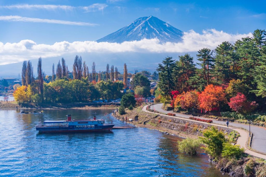
The five lakes surrounding Mount Fuji—Lake Kawaguchi, Lake Yamanaka, Lake Saiko, Lake Shoji, and Lake Motosu—are located in the caldera (crater) of past volcanic eruptions. These lakes have been shaped by the interplay of volcanic activity and glacial processes, creating stunning bodies of water that reflect the grandeur of Mount Fuji itself.
The most significant of these lakes is Lake Kawaguchi, which was formed by volcanic activity around 20,000 years ago. The caldera that created the lake was shaped by an ancient volcanic eruption, which allowed water to collect in the basin formed by the eruption’s aftermath. Today, the lake is a popular destination for boating, fishing, and hiking, offering panoramic views of Mount Fuji from its shores.
Lake Yamanaka, the largest of the five lakes, was also formed through volcanic processes. It sits at the base of Mount Fuji and is surrounded by dense forests and small villages, creating a serene and picturesque landscape. The lake’s clear waters and the surrounding lava rocks provide a unique environment for studying volcanic ecosystems.
3.2 Volcanic Influence on Local Biodiversity
The presence of lava rock zones and volcanic lakes has created a rich environment for wildlife and plant species around Mount Fuji. The lakes are home to a variety of waterfowl, and the surrounding forests are inhabited by species such as deer, wild boar, and various types of birds. The lava rock fields themselves, though seemingly barren, also host a variety of low-growing plants that are uniquely adapted to the harsh conditions of volcanic soil.
The volcanic soil around the lakes is rich in minerals, providing an abundant source of nutrients for plants. This allows a diverse range of species to thrive, creating a dynamic and balanced ecosystem. For ecologists, the interaction between volcanic geology and local biodiversity offers fascinating insights into the ways in which ecosystems evolve in response to geological changes.
4. Mount Fuji’s Geological Significance
4.1 A Volcanic Laboratory
Mount Fuji is often referred to as a living laboratory for volcanologists, who study its eruptive history, lava flows, and crater formations to better understand volcanic activity and its impact on the environment. The lava rock zones surrounding the mountain offer valuable data on the composition of lava, the patterns of eruption, and the effects of eruptions on surrounding ecosystems.
By studying Mount Fuji’s lava fields, scientists can gain insight into the behavior of stratovolcanoes, their eruption cycles, and how these mountains influence the climate and local landscapes. The age of the lava rocks, along with the different lava flow structures, helps geologists create models of how volcanic landscapes evolve over time.
4.2 Mount Fuji’s Role in Earthquake Science
In addition to being a volcanic feature, Mount Fuji is located within the tectonically active region of Japan. The movement of the Pacific Plate beneath the Eurasian Plate creates seismic activity that affects the region surrounding the volcano. Researchers use the study of Mount Fuji’s lava rock zones to better understand the relationship between volcanoes and earthquakes, as the region is known for its frequent seismic events.
By analyzing the layers of lava and volcanic ash, scientists can gain insights into the historical seismic activity that has shaped the region. Understanding the interplay between volcanic eruptions and earthquake activity is crucial for predicting future events and mitigating potential risks.
Conclusion: A Dream Destination for Geologists and Nature Lovers
The lava rock zones of Mount Fuji and the surrounding natural landscapes are truly a geological wonderland. From the ancient lava flows and basaltic formations to the lush forests and serene lakes, this region offers a comprehensive look at the power and beauty of volcanic activity. Mount Fuji’s volcanic history and its natural wonders continue to inspire awe and fascination among geologists, scientists, and nature enthusiasts from around the world.
For those seeking a deeper understanding of volcanic processes, lava rock formations, and the interaction between geology and ecology, the areas surrounding Mount Fuji represent an unparalleled opportunity for exploration. Whether you are an adventurer, a student of geology, or simply someone seeking the beauty and majesty of nature, Mount Fuji’s lava rock zones offer a rare glimpse into the dynamic forces that shape our planet.
As we continue to study and protect this geological marvel, we are reminded of the Earth’s constant change, its ever-shifting landscapes, and the remarkable ability of nature to adapt and flourish in even the most extreme environments.


